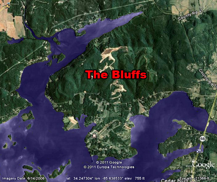
Maps and Directions to The Bluffs
From Rome (25 miles): Go West on GA Highway 20 which will become AL Highway 9. Proceed to
Cedar Bluff (approximately 25 miles), turn right on AL Highway 68. Proceed exactly 2 miles and turn left on
County Road 44. Proceed west on County Road 44 for 2.2 miles to see the entrance to The Bluffs.
From Gadsden(30 miles): Follow AL Highway 411 to Centre, then follow Highway 68/9 to Cedar
Bluff. In Cedar Bluff turn left on Highway 68 and go exactly 2 miles to County Road 44. Turn Left on C.R. 44
and proceed for 2.2 miles to see the entrance to The Bluffs.
From Ft. Payne(23 miles): Follow AL Highway 35 to Gaylesville. At the 4-way stop in
Gaylesville, turn right on AL Highway 68 and proceed approximately 2 miles to County Road 44. Turn right on
C.R. 44 and proceed west for 2.2 miles to see the entrance to The Bluffs.
(B) Centre, (C) Rome, (D) Fort Payne (E) Gadsden. And The Bluffs of Weiss is indicated by the red (M). And a little closer view of the area. And now a closeup just around The Bluffs. The Bluffs is a mountain that projects out into the lake, almost totally surrounded by water, giving practically every homesite year round views of the water. And finally, the roads entering into The Bluffs. Take highway 9 from Rome into Cedar Bluff, turn right (1) onto state highway 68, cross the bridge, then left (2) onto county road 44. Watch for the entrance into The Bluffs on the right (3) about one quarter mile down county road 44. 
|